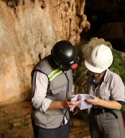
Fundamental Part of Environmental Permitting for Projects in Areas with Potential Cave Occurrence.
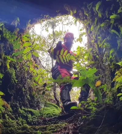
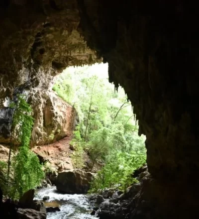
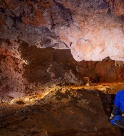
Speleology is the science that studies caves, grottos, and other subterranean environments, being essential for risk and opportunity analysis in Environmental Permitting. Understanding the complexities of these karst landscapes, which can include underground rivers, rare speleothems, and specific fauna, is vital to ensure a robust and sustainable environmental permitting process.
CONHEÇA
MAIS SOBRE
AS NOSSAS
SOLUÇÕES E
COMO
PODEMOS
TE AJUDAR
Speleological Management Plan
When a cavity with special attributes is targeted for visitation, tourism, and sports use, it is required by law that the responsible party develops a speleological management plan to minimize the impacts of this practice on the environment. The plan starts with general environmental diagnosis stages of the cavity and its influence area; identification of its sensitive portions; visitation support capacity; associated risks; and the distribution of threatened species. Subsequently, with this complete scenario concluded, it is possible to apply zoning and establish the rules for the ideal use of the location, avoiding its degradation and preserving the heritage in the long term for future generations.
Based on the evaluation of speleological environmental impacts and according to specificities, it becomes mandatory in environmental permitting processes to implement control, monitoring, mitigation, and compensation actions. Regarding speleological heritage, the main demands refer to monitoring speleological features according to the project's stage. The project or cavity use must be evaluated based on the impacts and emissions, and for each, a type of monitoring may be required, such as monitoring the physical integrity of the cavity and its influence area; monitoring cave-dwelling fauna; microclimate; hydrological and sedimentary conditions; photographic and seismographic monitoring.
Compensation arises from the need, evaluated in environmental permitting processes, for the project to cause real irreversible negative impacts on a cavity. Thus, the compensation will depend on the relevance level that the cavity to be impacted possesses. Each relevance level prevents or restricts the forms of compensation. That is, there is a relevance level that does not allow impacts and compensations; a level that allows compensation with other cavities with similar characteristics; levels that allow other forms of compensation; and a level that does not require compensation. Therefore, depending on each case, it is necessary to evaluate the available options to better balance the sustainability and viability of generating impacts on speleological heritage.
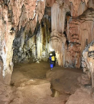
The analysis of Speleological Relevance applies to cases where natural underground cavities become targets of real irreversible negative impacts. It involves applying a legally prescribed method through physical, biological, and historical-cultural analyses on local and regional scales, determining the cavity's relevance level: maximum, high, medium, or low. Each relevance level implies a specific type of preservation and compensation management. It is an excellent way to conduct the strategic planning of a long-term project, along with potential expansions and limitations due to locational rigidity.
Considering the scenarios of each stage of a given project, the scope involves analyzing the forecast of its emissions and potential alterations to the speleological heritage. In the absence of impacts or potential impacts, it is possible to reconcile the project's development near a speleological heritage, accompanied by monitoring actions and environmental improvements. In case of identifying irreversible negative impacts, it becomes mandatory to analyze the relevance to define how to manage the future condition of natural underground cavities.
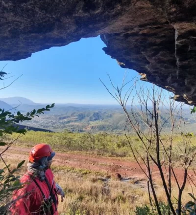
In specific cases, depending on the project and its proximity, technical analysis for the Delimitation of a Specific Influence Area of natural underground cavities allows for detailing based on socio-environmental factors. This involves analyzing local environmental attributes to refine a minimum necessary area for maintaining and preserving the feature, different from the 250m radius defined by legislation. Physical, biological, sociocultural, and prehistoric factors are necessary approaches, providing more parameters than the arbitrary 250m radius initially defined as the influence area. Depending on the case, the project can adjust to a new delimitation.
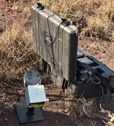
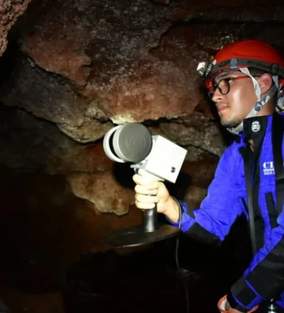
Speleotopography involves mapping and calculating the dimensions of speleological features. Currently, there are two available methods: conventional and three-dimensional. The conventional method requires the team's presence on-site to take measurements and plot them for later digitization, where calculations are applied to obtain the feature's dimensions. The three-dimensional method requires using specific technological equipment for field capture, with data processed subsequently. This data is important for the project's dimensioning, and the Speleotopography stage can be executed alongside Prospection.
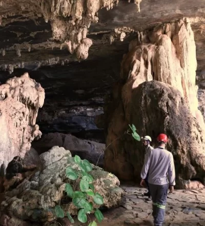
Prospection and Analysis of Speleological Potential
Na etapa de Prospecção e Análise da Potencialidade Espeleológica são iniciados os estudos para refinar o potencial de ocorrências de cavidades, definir a densidade de caminhamento necessária e realizar a atividade de campo. No campo, percorre-se uma área delimitada para identificar e caracterizar feições espeleológicas. Vários atributos da paisagem são mapeados e integrados para se atingir o potencial espeleológico local, determinando as necessidades detalhadas de densidade do caminhamento. Equipes especializadas percorrem a área alvo, devendo atingir o mínimo de densidade de percurso definidas na análise de potencial, para amostragem e confirmação do potencial espeleológico real, assim como identificar e caracterizar feições espeleológicas.
A Análise de Viabilidade Ambiental do Empreendimento corresponde a uma etapa prévia ao Licenciamento Ambiental. Nela, são realizadas consultas às bases públicas disponíveis de ocorrências de cavidades naturais subterrâneas e de potencial espeleológico e geológico. Em paralelo, é feita uma interpretação da paisagem com imagens acessíveis para detalhar essa potencialidade. Em seguida, através dos resultados obtidos, faz-se uma análise legal em função de aspectos permissivos, restritivos ou impeditivos, conforme o nível previsto de licenciamento, nas esferas municipal, estadual ou federal.
With Clam, you'll be joining a team of dedicated specialists committed to helping your company achieve excellence in ESG, Corporate Sustainability, and Integrated Management Systems.
We are committed to providing personalized and high-quality services that will significantly contribute to the sustainable and responsible growth of your business.
Trajetória
de Sustentabilidade
Temos orgulho em ser uma parceira chave para encaminhar e direcionar as organizações na trajetória de sustentabilidade, oferecendo não apenas consultoria, mas uma parceria estratégica para a implementação de práticas sustentáveis que geram valor real e impacto positivo.
Nossa experiência, combinada com a habilidade de trazer resultados práticos e efetivos, nos posiciona como a escolha ideal para a sua empresa no campo da consultoria em sustentabilidade.


![pt_BR[1]](https://clam.com.br/wp-content/uploads/2025/11/pt-br1.svg "pt_BR[1]")
![en_US[1]](https://clam.com.br/wp-content/uploads/2025/11/en-us1.svg "en_US[1]")