Success Cases

Status
In progress
Year
2024 e 2025
Category
Mobilização Social para Ações do PAEBM
Context
Desenvolvimento de estratégias de mobilização e engajamento social das comunidades locais, para promover a ampla divulgação das informações sobre as ações do PAEBM – Programa de Emergência de Barragens de Mineração, viabilizando a participação popular na pauta de segurança e difundindo a cultura prevencionista.
Methodology performed
Contratação de moradores locais para atuarem nas atividades de mobilização junto às equipes Clam para as ações do PAEBM (Simulados Práticos, Seminários Orientativos e Testes de Sirenes), promovendo a inclusão da comunidade nas atividades realizadas pelo empreendimento na região e fomentando o desenvolvimento socioeconômico local, com apoio na geração de trabalho e renda.
Results
A participação ativa dos moradores locais nas ações de comunicação prévias aos eventos do PAEBM contribuiu para a valorização do conhecimento da população local sobre o território, o fortalecimento dos vínculos comunitários e o aumento da credibilidade das informações repassadas pelas equipes. As atividades levaram informação e conscientização para mais de 200 famílias locais e incentivaram o aumento do engajamento dos moradores nos eventos de segurança do PAEBM.

Status
Complete
Year
2020
Category
Hydrogeological model
Context
Development of a conceptual hydrogeological model of a mine in Moatize, a city in the province of Tete in Mozambique.
Methodology performed
Results
This work allowed the characterization of the underground water dynamics and its geometry as well as the configuration of the aquifer units, recharge and discharge zones, the vulnerability of these hydrogeological systems to possible contaminants, and the water availability inherent to the project in question and some adjacent areas.

Status
Year
2019
Category
Animal Care
Context
Development of technical, administrative and management services for an animal reintegration program in a fauna shelter located in the region of Brumadinho, Minas Gerais, Brazil.
Methodology performed
The services in question consist of the development of activities for the reception, treatment and shelter of hundreds of domestic and wild animals in a specific structure, operating 24 hours a day. These services include the necropsy of animals from the fauna shelter or brought from other rescue fronts.
They also include the promotion of welfare and environmental enrichment for the animal with a view to the reintegration of each of the rescued animals, in addition to the management of the adoption process based on specific protocols and other activities.
Results
Clam's team was able to provide efficient demand management for the client, resulting in cost reduction and achievement of goals for disease and injury prevention and treatment, pain and stress prevention and relief, immunization, provision of appropriate food, and other conditions tailored to the animals' needs.

Status
Year
2019
Category
Services in Ichthyofauna
Context
Evaluation of the influence of dredging on schools of fish and the evaluation of impacts on the drift of eggs and larvae (ichthyoplankton) in the Paraopeba River, in Minas Gerais, Brazil.
Methodology performed
The services consist of the development of environmental programs for the collection of carcasses, monitoring of dredging and shoals, fish harvesting, monitoring of water quality parameters, monitoring of ichthyoplankton in addition to necropsy for the evaluation of ichthyofauna causa mortis. At the peak of the work, a team of professionals was mobilized, in addition to all the necessary resources such as vessels, vehicles, engines, as well as all the necessary certification of the personnel involved.
Results

Status
Year
2020
Category
Decharacterization of geotechnical structures
Context
Methodology performed
For the development of these services and to meet the demands of the Customer, a robust multidisciplinary team was selected to operate in company with strong technical expertise and different levels of seniority dedicated to complying with the regulations and legislation related to the theme as issued by the different regulatory bodies involved. in company com forte expertise técnica e diferentes níveis de senioridade dedicada ao atendimento às determinações e legislação relacionada ao tema emanada pelos diferentes órgãos reguladores envolvidos. in company com forte expertise técnica e diferentes níveis de senioridade dedicada ao atendimento às determinações e legislação relacionada ao tema emanada pelos diferentes órgãos reguladores envolvidos.
Results

Status
Year
2020
Category
Forest fires
Context
Development of a plan for monitoring of surface waters, bottom sediments, soils, fish, fruits and tree canopy as a result of the application of flame retardants in areas where forest fire mitigation actions are planned in the state of Pará, Brazil.
Methodology performed
For the development of the services, collections and laboratory analyses of samples were necessary to assess the impacts resulting from the application of the retardant based on the legal/regulatory parameters of the resolutions of the National Environment Council, Brazilian Association of Technical Standards, National Water Agency, National Sanitary Surveillance Agency and the Brazilian Agricultural Research Corporation, Brazilian agencies that govern the subject in question. The evaluation of the canopy by aerial images of the application areas was carried out using drone overflights. An evaluation of possible impacts was also provided, such as the significant loss of canopy leaves, changes in the canopy color pattern and tree mortality.
Results

Status
Year
2019
Category
Environmental monitoring
Context
Methodology performed
For the development of services, the Clam team provided, among others, the following services: characterization and qualitative and quantitative hydrogeological/hydrological monitoring, background hydrogeochemical characterization, characterization of acid drainage generation potential, water studies to define water balance and pit dewatering, technical studies for water use permits and effluent discharge permits, development of the Environmental Management System to be used during mine operation, as well as fauna and flora monitoring and environmental licensing for the landfill and concrete plant that will serve the project.
Results

Status
Year
2019
Category
Archaeological monitoring of emergency works
Context
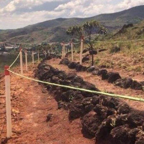
Monitoring works to de-characterize dams, with a view to identifying archaeological structures to prevent possible impacts on Archaeological Heritage.
Methodology performed
Hiking activities, by Archeology professionals, in the areas affected by the works, identification, isolation and signaling of archaeological assets, dissemination of knowledge to collaborators of the works and communication of preventive actions to Organs competent bodies, through official letters and/or technical reports.
Results

Status
Year
2019
Category
Speleological studies in general
Context
Assessment of speleological potential, prospecting, area of influence studies, relevance studies, monitoring in mine operation areas, in order to assess potential impacts.
Methodology performed
Surveys in speleological databases; walking/mapping in the field; detailed topographic surveys; biospeleological and geospeleological surveys, monitoring of particulate matter; photographic monitoring; physical integrity monitoring; monitoring of cave fauna.
Results

Status
Year
2019
Category
Conceptual and executive level closure plan
Context
Mine operations with the need to plan structured actions, in line with the best international practices, in order to guarantee the physical and chemical stability of the structures, enabling the future use and socio-environmental sustainability of the enterprise in the decommissioning and post-decommissioning phases.
Methodology performed
Details of actions related to decommissioning, such as the process of definitive decommissioning of structures, associated aspects and impacts, applicable control and mitigation measures, evaluation of possible future uses, justification for the chosen future use, costs involved and schedule.
Results

Status
Year
2019
Category
Environmental investigation of liabilities
Context
Development of the Preliminary Assessment Report and the Confirmatory Investigation Plan in areas of paralyzed mines.
Methodology performed
Survey of primary and secondary data, including, for example, temporal aerial photogrammetric survey, in order to characterize changes in land use and occupation in the target area and its surroundings; field interviews and inspections. The Confirmatory Investigation Plan is prepared according to the availability, quality of data and information obtained, which will underlie the Initial Conceptual Model of the Area - MCA, with its different levels of uncertainties.
Results
Through the collection of data and developed studies, the aim is to find evidence, clues or facts that allow suspecting the existence of contamination in the areas, verifying the need or not to continue the investigation (execution of the Confirmatory Investigation Plan).

Status
Year
Category
Plano Integrado como estratégia de resposta à incêndio florestal
Context
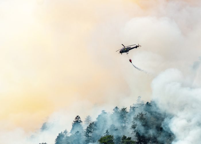
Altas temperaturas, material combustível e oxigênio formam a combinação perfeita para a ocorrência de incêndios florestais. No Brasil, esses eventos são mais comuns entre maio e outubro, devido à diminuição da precipitação e umidade relativa, além da intensificação dos ventos.
Methodology performed
Desenvolvimento de um Plano de Resposta a Incêndios Florestais (PRIF), sendo necessário realizar uma análise integrada de dados históricos e informações sobre o território. Incluindo a coleta de dados primários e secundários, como características da vegetação, hidrografia, topografia, rotas de acesso e infraestrutura disponível.
Results
Com base na análise dos dados, foi possível estruturar um banco de dados geográfico que sustenta a elaboração de uma matriz de risco. Isso permitiu a criação de um PRIF eficiente, com recomendações como o incremento nos sistemas de monitoramento, otimização dos fluxos de comunicação e aprimoramento das equipes e estruturas de suporte.
